
Learn More: UScellular & Geotab Team on Telematics
Geotab Teams With Nonprofit to Plan for Electric Freight
Using data provided by Geotab, nonprofit The Ray will be able to determine the optimal locations and design for electric vehicle charging stations and help make EVs more accessible.
October 7, 2021
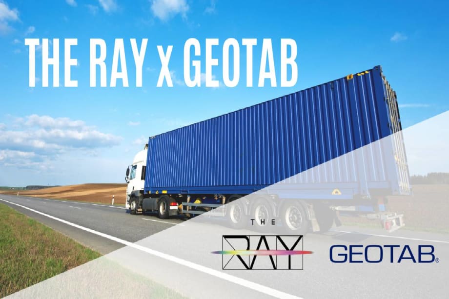
Using data provided by Geotab, nonprofit The Ray will be able to determine the optimal locations and design for electric vehicle (EV) charging stations and help make EVs more accessible.
Photo: Geotab
2 min to read
The Ray, a nonprofit testbed for sustainable transportation, has announced a fleet electrification study to analyze the movement patterns of medium- and heavy-duty freight vehicles on select American interstates and highways. Using data provided by Geotab, The Ray will be able to determine the optimal locations and design for electric vehicle (EV) charging stations and help make EVs more accessible.
The analysis performed by The Ray will begin with two pilot corridors: one regional along I-20 from Dallas, Texas, to Atlanta, Georgia, and the other local, from the Port of Savannah, Georgia, to the inland port in Atlanta, Georgia. Geotab will develop and provide data visualization tools, such as graphs and heat maps, allowing The Ray to easily dial into the analysis and leverage telematics-rich data insights to determine the most strategic locations to build medium- and heavy-duty charging infrastructure along the two corridors. The data will also help The Ray better understand where and what type of additional truck parking is needed for electric vehicles.
“The data provided by Geotab gives The Ray access to fleet movement data, as an overlay for our Esri Row solar mapping tool, to prepare for the planning of EV charging infrastructure sites and medium/high-voltage direct current transmission and distribution grid upgrades with our public and private partners," said Allie Kelly, The Ray’s executive director.
The Ray will also use the Geotab data to determine the land size needed to support medium- and heavy-duty EV charging, optimize charging schedules, and create EV charging locations as close to the corridor as possible, to help increase efficiency while on the road and minimize miles driven. Improving charging infrastructure helps make electric vehicles more efficient and affordable. These advancements in EV charging infrastructure will then act as the foundation for The Ray’s ultimate goal - the development of EV charging lanes to charge as the vehicle is still in motion.
Originally posted on Work Truck Online
More Electric Vehicles
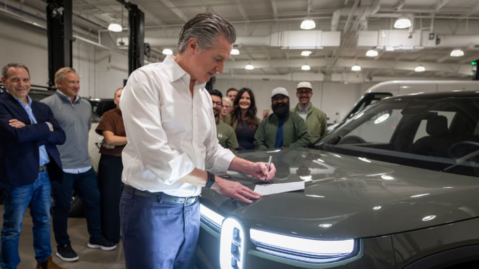
California Governor Approves Instant ZEV Rebates For First-Time Buyers
That instant rebate is the centerpiece of a broader $600 million package Governor Newsom signed into law, keeping California active in the global clean transportation race.
Read More →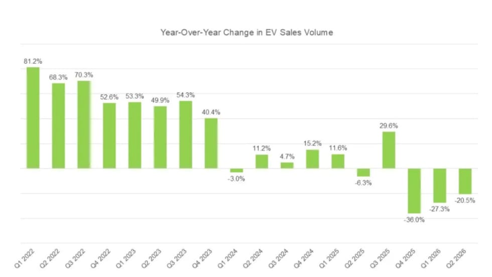
New Vehicle Models Stabilize Electrified Market In Q2
But more credit goes to hybrids than to all-electric vehicles, as more buyers look for fuel-efficient alternatives amid high gas prices.
Read More →
Xos White Paper Asserts LA Olympics Will Lack Enough EV Chargers
The commercial EV fleet company recommends some faster and more flexible remedies to relieve the anticipated shortfall.
Read More →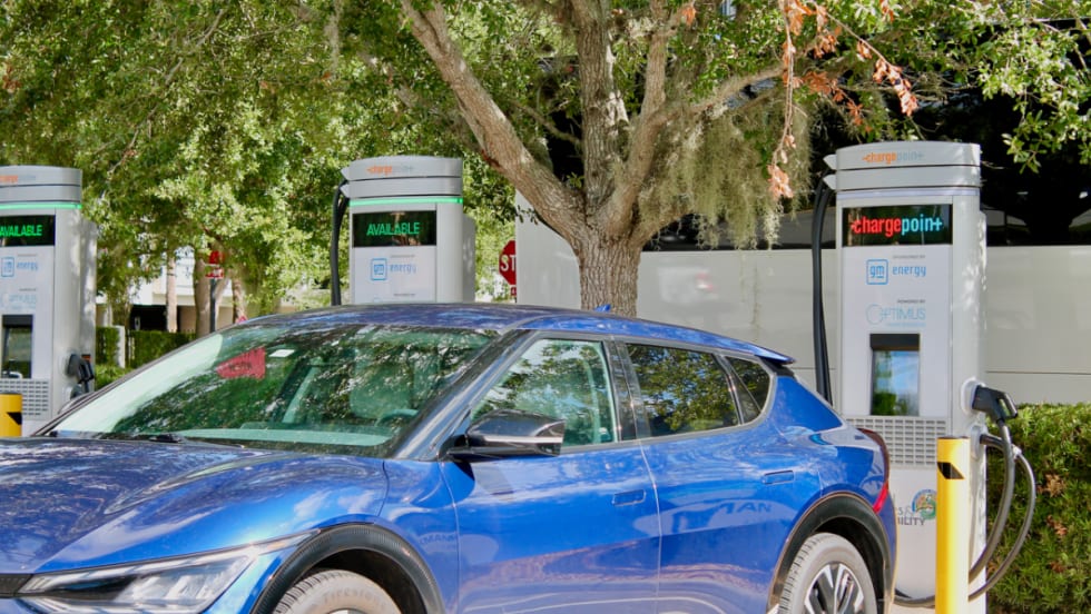
ChargePoint, Optimus Expand Fast-Charging Network Across Southeastern U.S.
ChargePoint will serve as the exclusive solutions provider, delivering hardware, software, and services to support Optimus’ growing charging network.
Read More →
Running A Profitable Electric Rental Fleet
How do you successfully operate an all-electric rental car fleet? Whether you manage a rental fleet or another commercial fleet, this conversation offers practical lessons on deploying, operating, and scaling electric vehicles.
Read More →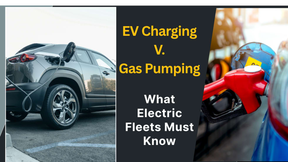
Why Charging May Never Be As Easy As Filling Up Gas
A seamless charge depends on a string of independent companies getting it right together, every time. How can electric fleets navigate the challenges to create a successful charging plan?
Read More →
Slate Debuts Colorful, Unique EV Models
A recent media and client event, studded with electric vehicles dressed up on platforms, planted a new position for the manufacturer in the wider EV market. Fleets will find cost-saving advantages.
Read More →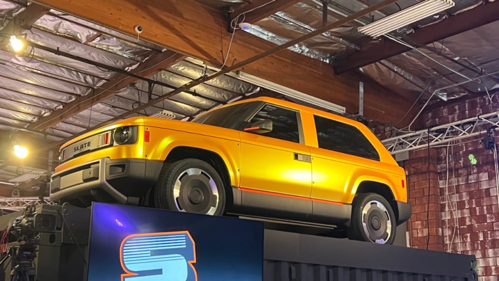
Slate Electric SUV, Pickup Switchable Model Aims For Light-Duty Fleets
Everything about this EV is counterintuitive and understated, making it stand out from the crowd.
Read More →
Polestar Barred from U.S. Market Under Connected Vehicle Rule
The automaker loses its authorization to sell new vehicles in the U.S., starting with the 2027 model year. Polestar owners will retain access to the brand's service network.
Read More →
Uber, Nuro and Lucid Plan Houston Robotaxi Service in 2027
The tripartite venture brings out the combined advantages of electric vehicles, mobility, and autonomy into ground transportation.
Read More →